O’Dell Engineering Accelerates Technology Services with Leo Castillo Joining as Survey Technology Division Manager
O’Dell Engineering is excited to announce that Leo Castillo has joined our multidisciplinary team. Mr. Castillo will lead the Survey Technology Division at O’Dell and will fuel the expansion of our 3D & Reality Capture services including Building Information Modeling (BIM), High-Definition 3D Laser Scanning (HDS), GIS, and Unmanned Aerial Vehicle (UAV) Mapping and Surveying. The addition of Mr. Castillo further diversifies O’Dell Engineering’s capacity to offer high-technology services alongside traditional surveying and engineering services, resulting in additional value and cost savings for our clients.
Throughout his seventeen year career, Mr. Castillo has been at the forefront of developing 3D design, 3D survey and 3D construction workflows to benefit project coordination, risk management, and cost control. His diverse project experience includes large-scale transportation and master planning efforts, as well as local community improvement projects. Mr. Castillo recently served as BIM Manager for the world-renowned Apple Park project in Cupertino, CA. He led the 3D laser scanning construction verification program for various buildings across the campus, as well as the Apple Park Siteworks Grading & Utility BIM Management program, which involved modeling and coordination of sitewide grading and underground utilities for the Project Surveyor, contractors, and designers.
Since 1996, O’Dell Engineering has been providing trusted and sought-after civil engineering, surveying, land planning, and landscape architecture services. The firm is proud to maintain a 97% Client Satisfaction Rating. With offices in Pleasanton, Modesto, Fresno, and Palo Alto, O’Dell is well positioned to serve public and private clients throughout the San Francisco Bay Area, Central Valley, San Joaquin Valley, and Greater Sacramento Area.
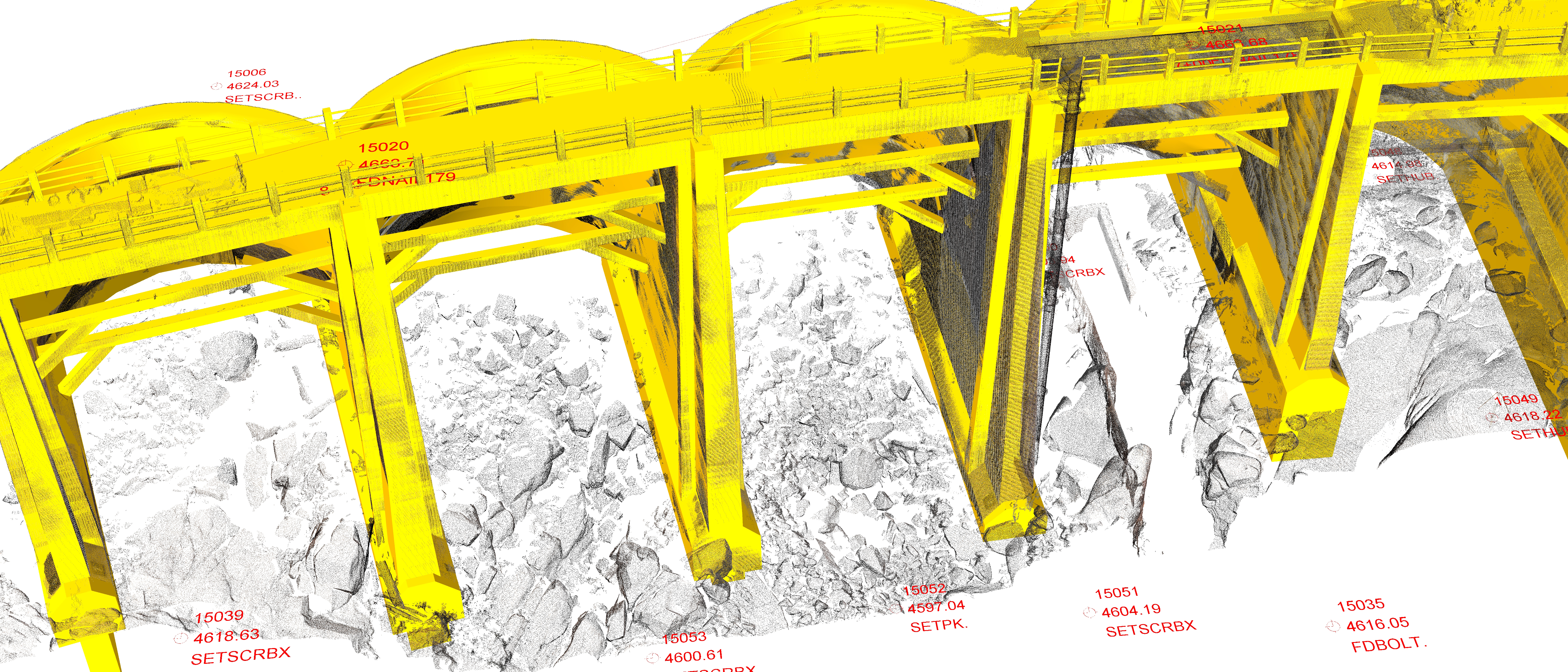
O’Dell has offered 3D Laser Scanning services to our clients since 2013. 3D Laser Scanning or HDS (High Definition Surveying) is a state-of-the-art and rapid measurement technology that captures high detail and millimeter accuracy of terrain, interior and exterior building faces, and mechanical systems and environments. Complex structures and systems that would take days or weeks to measure by traditional means are verified in seconds, resulting in highly-detailed 3D point cloud models.
We are thrilled at the addition of Mr. Castillo to our team. He will provide skilled BIM and coordination services for our design & construction clients. A recent study forecasted the Global BIM market to grow by almost 20% by 2018, further demonstrating the increasing demand for these highly skilled services.
To schedule a demonstration or request a proposal for our Scanning, BIM, and/or UAV services, please visit our Survey Technology Services Page.
More information about Mr. Castillo can be found via his LinkedIn.